- Topics
-
Topics
See our analysis on civil society and how it shapes culture, politics, and policies
Read our insights on the shifting political landscape and what it means for Palestine
Learn more about the policies and practices shaping the Palestinian economy
Strengthen your understanding of the unique conditions for Palestinian refugees across the Middle East
-
- Analysis
-
Analysis
In-depth analysis on existing or potential policies that impact possibilities for Palestinian liberation.
Insights and perspectives on social, political, and economic questions related to Palestine and Palestinians globally.
Concise analysis into a specific policy, its background and implications.
Commentary that brings together insights from multiple analysts.
Compilations of past Al-Shabaka works surrounding a specific theme.
Longer-form, ad hoc projects that seek to confront research questions outside the scope of our regular analysis.
A policy-driven research initiative by Al-Shabaka: The Palestinian Policy Network.
Our monthly webinar series that brings together Palestinian experts.
Featured
The advisory opinions issued by the International Court of Justice on Palestine reveal both the possibilities and the limits of international law, which has come under intense scrutiny amid the Israeli regime’s ongoing genocide in Gaza and broader settler-colonial project across Palestine. Acknowledging the persistent gap between legal principle and political enforcement, this policy brief examines how these opinions can be leveraged to strengthen legal and diplomatic accountability at both the international and domestic levels. It argues that the opinions provide an opportunity to move legal discourse on Palestine beyond the dominant UN framework of statehood within the 1967 borders and to reassert the Palestinian people’s right to self-determination within a broader liberation-oriented framework aimed at ending settler colonialism and advancing justice for Palestinians as a whole. Dana Farraj· Jul 1, 2026
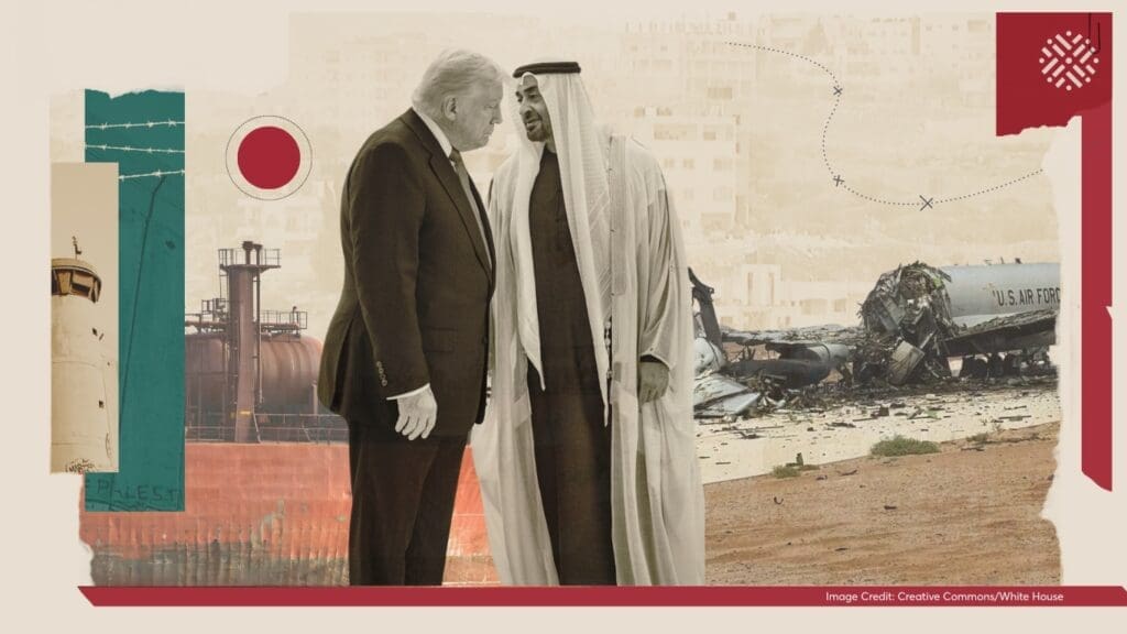
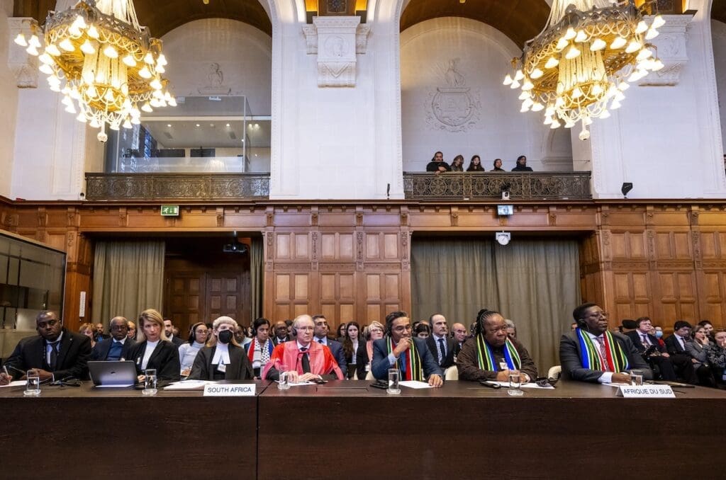 The US-Israeli war on Iran and Lebanon, as well as the ongoing genocide in Palestine, are reshaping the political landscape of the region. Alliances are being recalibrated, and old assumptions about US power are being tested. The war has also underscored how deeply the global economy remains tied to fossil fuels and to the strategic importance of the Gulf within international energy and trade networks. In this roundtable, Palestinian analysts Diana Buttu and Adam Hanieh examine what this moment reveals about the changing architecture of US imperial power, the regional order now taking shape, and the implications for the struggle for Palestinian liberation.

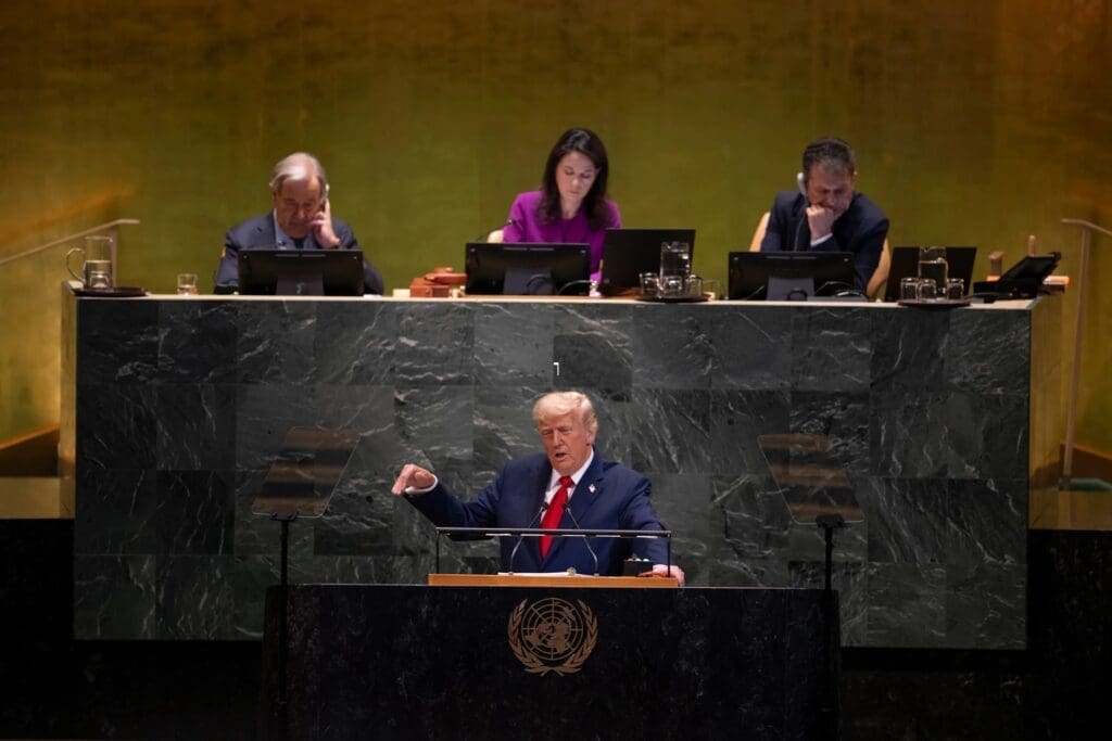
 People across the world are living through a moment of profound crisis. The ongoing genocide in Gaza, the US-Israeli war on Iran and Lebanon, the resulting energy and economic shocks, and the erosion of the international legal order are unfolding alongside the fragmentation of the Western-led global system. Together, these converging tremors are exposing the limits of US hegemony, reshaping the strategic positions of Arab Gulf states and China, and intensifying debates over multipolarity, regional realignment, and South-South solidarity. In this roundtable, Yara Hawari and Tareq Baconi reflect on this impasse, highlighting the centrality of Palestine to understanding the historic transformations the world is witnessing today. They discuss the bankruptcy of the liberal international order, the changing dynamics of the US-Israeli imperial power in West Asia, and the ways Palestine has emerged as a converging point through which a different global order may be forced into being.

-
- Resources
- Media & Outreach
- The Network
Satellite Imagery and the Palestine-Israel Exception
Introduction
In the United States and beyond, the rules that apply to the rest of the world have long applied differently to Palestine-Israel. In the US, this exceptionalism often manifests as censorship of Palestinian perspectives and operates on many different levels: On university campuses, Palestine has become the exception to free speech, and in local government, Israel marks the exception to the right to boycott. Remarkably, this exceptionalism even extends to the quality of aerial photography and satellite imagery of Palestine-Israel.
Bipartisan legislation passed by the US House of Representatives in 1997 limits the quality of aerial photography of Palestine-Israel available to the public through platforms such as Google Earth and Bing Maps. The Kyl-Bingaman Amendment (KBA) to the US National Defense Authorization Act restricts the availability of high-resolution satellite imagery by preventing satellite operators and retailers in the US from selling or disseminating images of Palestine-Israel at a resolution higher than that available on the non-US market. The result: limited access to clear aerial photography of Palestine-Israel.
Large parts of the Middle East and North Africa are covered by very high-resolution imagery with an average resolution of around 0.5 meters (per pixel). Any object larger than this size is visible in some form on satellite images, including most archaeological sites across the Arab world. Images whose maximum resolution exceeds two meters are unclear. From an archaeological perspective, this prevents an accurate picture of the changing landscape.
In contrast to the rest of the region, images of Palestine-Israel deliberately have the lowest resolution. This is due to the KBA, which cited Israeli national security concerns as for the reason for limiting the public provision of high resolution imagery of Palestine-Israel. Consequently, a two-meter resolution standard has been the “perceived baseline” of what can be sold on the commercial imagery market, including what is made available on platforms such as Google Earth.
Although the legislation was implemented under the pretense of protecting Israel’s national security, it is better characterized as an act of censorship. By deliberately blurring aerial images of Palestine-Israel, the KBA hinders the work of archaeologists, environmentalists, geographers, and humanitarians. It poses serious obstacles, not only for the preservation of cultural heritage, but also for holding Israel to account for land grabs, home demolitions, and settlement activity.
While the legislation only applies to US companies, their hegemony in the commercial market for satellite imagery has elevated the legislation to de facto institutionalization on a global scale, affecting the access of researchers worldwide. Since 2012, however, there has been a steady increase in non-US-based satellite companies deploying advanced satellite technologies to produce very high-resolution imagery of Palestine-Israel. In rendering the KBA anachronistic, these developments call for a reconsideration of the legislation and regulations that uphold it.
Following the research of the Endangered Archaeology in the Middle East and North Africa (EAMENA) project, which assesses satellite imagery (and historical aerial photography) to study landscape change and record the condition of archaeological sites, often relying on Google Earth and Bing Maps – and particularly the findings of Dr. Andrea Zerbini and Dr. Michael Fradley of Oxford’s School of Archaeology – this commentary calls for the KBA and its corresponding regulations to be declared obsolete. It makes the case for an open skies policy in Palestine-Israel in order to provide full access to scientists, researchers, and humanitarians looking to use technological advances in their work. Additionally, an open skies policy has benefits for Palestinians since accurate images of Palestine-Israel can advance discussions surrounding colonial spatial practices and ways to decolonize them.
The Kyl-Bingaman Amendment
Passed in the post-Cold War uncertainty of the 1990s, a reporter from the Wall Street Journal observed that the KBA legislation was “the first step away from the open-skies policy that the US and other countries have agreed to for more than three decades.” Then-President Bill Clinton had long held a pro open skies policy and had previously sought to expand the burgeoning commercial remote sensing sector. The resulting flare in tension between the US and Israel had been simmering since 1992 when, under Israeli pressure, the US State Department cancelled an application from the United Arab Emirates to buy an imaging satellite from a US firm.
Then in 1994, a US satellite company attempted to build a ground station in Riyadh, enabling Saudi authorities to access high-resolution images of the region – including Palestine-Israel. This, too, was quashed following sustained Israeli lobbying of members of Congress. In 1995, the satellite company was compelled to guarantee that its satellites would not cover Israel.
Matters came to a head that same year when Clinton issued Executive Order 12951, declassifying more than 860,000 images taken by spy satellites between 1960 and 1972. The move sparked alarm and condemnation from the US’s Israeli allies, decrying the availability of such extensive geographical data as a threat to their national security.
Senator Jon Kyl, a Republican from Arizona, introduced the KBA in 1996 as a response to the declassification of the spy satellite photographs, which, he argued “could unintentionally have a deleterious impact on the national security of the state of Israel.” Meanwhile, Israeli officials were reportedly lobbying the Clinton administration to impose a three-meter resolution threshold on all commercial imagery providers covering Israel. The implementation of the amendment into law demonstrates the power and access of pro-Israel lobby groups whose reach, in this instance, extended deep into the inner workings of the US government to advance Israeli interests.
The text of the KBA is ambiguous, particularly with regard to its geographic scope. It was issued after the signing of the Oslo Accords in 1995 and subsequent creation of the Palestinian Authority in the West Bank and Gaza Strip. By only referencing Israel in the text, the legislation theoretically contains a loophole for commercial satellite companies to collect and disseminate imagery of the Occupied Palestinian Territory (OPT) – independent of restrictions on modern-day Israel. Nevertheless, in practice, the KBA’s restrictions apply throughout Palestine-Israel.
Though the law was implemented under the pretense of protecting Israel’s security, it is better characterized as censorship Share on XThere is also considerable confusion surrounding the maximum resolution permitted by the KBA that has resulted in conflicting interpretations by US regulators. Implementation of regulations concerning remote sensing are the responsibility of the US Department of Commerce and the National Atmospheric and Oceanic Administration (NOAA).
The NOAA is an underfunded body that has, over the years, struggled to keep abreast of the dramatic increase in the number and capabilities of commercial satellites and does not appear to have a system in place to monitor what imagery is available internationally. The NOAA website states clearly that compliance with the KBA is imperative for obtaining a commercial license. Specifically, applicants are required to submit documentation describing how their system would restrict the collection and dissemination of images of Israeli territory.
Satellite imagery has advanced significantly both in scale and diversity in the 22 years since the KBA was passed, and although the KBA was supposed to be reviewed regularly, there is little to suggest it has been.
The launch of Google Earth in 2005, followed by other open-access systems like Microsoft’s Bing Maps, Apple Maps, and a range of others now allow anyone with an otherwise uncensored internet connection to access satellite imagery worldwide. The explosive growth in the satellite imagery market has major monitoring implications for regulating bodies like the NOAA, but relics like the KBA remain untouched.
The use of aerial images should not be understated. From an archaeological, geographical, geological, and botanical perspective, it enables researchers to understand, identify, and document landscape changes. In much of the Arab world, covered at an average resolution of 0.5 meters, researchers in these fields have come to rely on imagery freely available through Google Earth and Bing Maps.
That Palestine-Israel is limited to two meters (sixteen times less detailed) has had a significant impact on researchers’ access to data. While it is possible to observe substantial changes in land use (for instance, the building of city-settlements in the West Bank or bulldozing of Palestinian structures), subtler changes are harder to discern. Oxford archaeologists Fradley and Zerbini confirm that “looting pits or the encroachment of small-scale developments can only be detected with sub-meter resolution imagery.”
More urgently, lower-resolution imagery has a significant effect on humanitarian efforts to document human rights violations and assess damage in hard-to-reach areas such as the Gaza Strip, under siege since 2005. Blurred images make measuring the damage inflicted on Gaza during the 2008-9, 2012, and 2014 military incursions significantly more challenging.
Finally, such overt censorship has a substantial impact on Palestinian groups. As a refugee population, over three million Palestinians live in exile outside Palestine-Israel, most with no recourse to return or visit. In such cases, technology can serve as a tool to tangibly imagine their right of return. Uncensored, high-resolution images enable Palestinians to accurately catalogue the remnants of villages and towns destroyed during the Nakba (catastrophe), denoting the loss of the Palestinian homeland and the expulsion of some 750,000 Palestinian Arabs in the events of 1947-48. Finally, from a decolonizing perspective, accurate and detailed images – both historical and contemporary – not only provide substantial proof of the ongoing colonial encroachment into occupied Palestinian land, but also allow Palestinians to actively imagine an alternative reality.
Challenges to US Censorship
The supply of very high-resolution imagery from non-US companies has expanded rapidly over the past six years, increasingly rendering the KBA restrictions obsolete. A range of non-US based satellite companies now offer very high-resolution images of Palestine-Israel with a resolution of 0.4-0.7 meters (in line with the global average).
The most significant sources of these images are the Pléiades: two very high-resolution earth observation satellites developed and operated by Airbus Defense and Space, under contract with the French Centre National d’Études Spatiales (CNES). Launched in December 2011 and December 2012, respectively, they cover all of the territory from the Jordan River to the Mediterranean Sea. Their findings have already yielded results in documenting Israeli violations of international law, notably in studies of damage experienced by Gaza in the 2014 bombardments.
While Airbus was the first to provide high-resolution imagery of Palestine-Israel commercially, it is no longer the only one. Since 2013, six other companies and space agencies have launched images at a resolution of below one meter. The trickle of high resolution imagery, write Zerbini and Fradley, “has now become a flood.” The challenge for researchers charting changes over time is the relative newness of the imagery. The archive of these new satellites goes back only a few years, making it difficult to document changes in the landscape and urban settlement expansion during the entire period that Israel has been active in demolishing, building, and otherwise reshaping the land.
Despite this recent availability of very high-resolution imagery of Palestine-Israel in other commercial markets, the perception persists that KBA restrictions still apply at the two-meter level for US companies. This points to a confusing reality stemming from the US Department of Commerce and NOAA’s failure to review the changes taking place and issue clear, up-to-date guidance to US satellite operators and imagery retailers. These entities should set the accepted resolution level based on a review of the level of commercially available imagery from outside the US.
From a decolonizing perspective, detailed satellite images allow Palestinians to imagine an alternative reality Share on XNot only did these bodies fail to issue updated regulations in the period following the release of Pléiades’ images on the market in 2012, the NOAA made no public statements on the KBA in the years between 2007 and August 2017. With the international resolution threshold now firmly at 0.5 meters, the US market continues to abide by the two-meter threshold put in place in 1997. There has been next to no official public discussion on the practicality of the KBA in recent years despite its clear obsolescence, and while there is an NOAA review currently underway, it is moving at a snail’s pace.
The debate around “open skies” is not limited to the commercial market, however. Google Earth and Bing Maps have quietly resisted these anachronistic limitations. In the past few years, there have been instances of Google Earth subtly putting up tiles of uncensored Airbus imagery covering pockets of Palestine-Israel and occupied Syria, including parts of the Israel-Lebanon border in the north, the northern and western Golan Heights and, most significantly, the northwest West Bank, with no attempt to lower the resolution of the images down to the two-meter US norm.
One can only speculate as to the reasoning behind US companies skirting the NOAA restrictions and disseminating such detailed imagery. It could be a critique of the outdated US restrictions. It could also represent tacit recognition of Palestinian and Syrian territory, which is legally understood as occupied and not part of modern-day Israel and thus not included in the KBA legislation. Regardless of the motivation, uncensored images de-exceptionalize Israel by levelling the playing field and providing increased access to scientists, humanitarians, and Palestinians alike.
Conclusion
With the proliferation of non-US commercial satellites capturing very high-resolution images of Palestine-Israel in recent years, the removal of the now-outdated censorship imposed by the Kyl-Bingaman Amendment is long overdue, as is a public discussion on its origins and purpose.
A levelling of the commercial playing field between US and non-US imagery providers can be achieved through disposing of the KBA amendment and modifying the regulations of the Department of Commerce and the NOAA. This will allow satellite operators to share high-resolution images of Palestine-Israel on widely-used open-access platforms and ensure their continued international competitiveness. Any such revisions are, however, dependent on the assessment of US policymakers and regulators, their respective political biases, and the lobbying efforts that target them.
Increased access to geospatial data unquestionably increases Israeli accountability Share on XFrom a transparency, open access, and human rights perspective, there are clear advantages to an open skies policy. For archaeologists, geographers, cartographers, and humanitarian groups active in Palestine-Israel, the presence of high-resolution imagery can be used to identify and track important and hard-to-reach sites, with an impact ranging from archaeological surveys to responses to Israeli violations of human rights and international law. Increased access to geospatial data unquestionably increases accountability and can be used to document Israeli settlement activity, demolition of Palestinian structures, military incursions into no-go areas like Gaza, environmental degradation, and the destruction of historical, religious, or archaeological sites in modern-day Israel and the OPT.
Ways Forward
1. The current resolution restrictions placed on US companies as stipulated by the Kyl-Bingaman Amendment through the Commerce Department and the NOAA should be immediately reevaluated to account for technological advancements and to facilitate open access for US and non-US actors. Detailed imagery of Palestine-Israel with a resolution of 0.5 meters has been available from non-US companies since 2011, when the first Pléiades satellite was launched. Since the Commerce Department sets the accepted resolution level, they must modify US regulations in line with what is available internationally and allow for US-based companies to declassify, buy, sell, and disseminate imagery worldwide at a resolution equal to other countries – or else lowered to 0.5 meters.
2. Advocacy groups, scholars, and satellite operators should pressure the NOAA to communicate changes in restrictions on US companies in their public meetings and in published materials. Similarly, the NOAA must hasten to complete its slow-moving review of the KBA.
3. An awareness campaign should target relevant parties, including technology companies, scientists, and humanitarians, informing them that higher-resolution imagery is publicly available.
4. Archival high-resolution imagery of Palestine-Israel collected by satellite operators, which was forced to be down-sampled and blurred for retail sale, should be re-released at the captured resolution to allow researchers to assess longer-term landscape changes. For example, restored imagery would show the remains of destroyed Palestinian villages and the erasure of the surrounding area as Israeli development transforms the landscape. This is done both through the deliberate planting of forests on these sites by groups such as the Jewish National Fund and urban development designed by architects and planners.
5. Members of Palestinian civil society worldwide should recognize the importance of high-resolution imagery for discussions on the Palestinian right of return and historical justice. This would serve as an accountability mechanism for destructive Israeli spatial practices but also as a decolonial tool in creating a roadmap for the return of Palestinian refugees.
Zena Agha
Zena Agha is the Interim Director of the British Palestinian Committee. She previously served as Al-Shabaka’s US Policy Fellow (2017–2019), where her research focused on Israeli spatial practices, climate change, and Palestinian adaptive capacities. She was awarded the Kennedy Scholarship to pursue an MA in Middle Eastern Studies at Harvard University and holds a PhD from Newcastle University, where her research examined colonial cartography in Palestine. Her writing has appeared in The New York Times, Foreign Policy, The Nation, The Independent, Foreign Affairs, NPR, and El País.
Latest Analysis
The ICJ Opinions on Palestine: Possibilities and Limitations
The Gulf and Israel: War, Normalization, and the Global Economy
Palestine, Iran, and the Unraveling of Western Hegemony
We’re building a network for liberation.
As the only global Palestinian think tank, we’re working hard to respond to rapid developments affecting Palestinians, while remaining committed to shedding light on issues that may otherwise be overlooked.